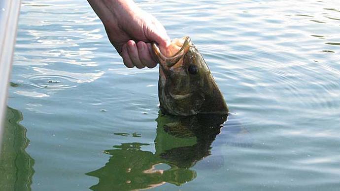
As fishermen, we face change on many levels, such as learning one of the newest tactics making waves in the bass world. To stay on top of the times, we must embrace these changes, figure out what is needed to stay current, and work to be successful and adapt to change. This change is easy for some but can be a struggle for others.
When breaking down new waters, are you comfortable learning what is at hand, or do you struggle to figure it out? The time frame is one of the most significant factors that puts this to the test. Do I have time on my side to break down these waters over a year, or am I faced with breaking down these waters on the fast track because I have a tournament coming up in a few weeks? A time restraint will change the outcome and dictate the learning process. Let’s discuss a few tactics I have put together over the years that I have found to make learning new waters easier.
Gather Preliminary Information
Gathering information is the first thing at hand. In the past, there was less aid to help in this process. You often depended on getting a paper lake map, hopping in your boat to turn on your flasher, and driving areas back and forth with the paper map on your lap to see what you could find. If you found something interesting, you threw a marker over the side and broke down the area until you contacted fish. What made this process harder was that many of the markers we used then were mini barbell shapes. They were two round balls with a line in between that would unwind with the slightest wind or waves, throwing your location off. Once fish contact was made, you would line up land markers on the shore so you could go back again. This tactic puts you off the mark to start.
Example: Line up the flagpole with the big window on the house in one direction, then line up the dock with a green boat cover as your side marker. You would then triangulate these two markers to return to the spot on the water next time.
For many years, that was what we had at our disposal to find critical areas again. There was no GPS to depend on or dropping a waypoint like we have today. I can also tell you that sometimes, you never really got back on your spot again that you found. It was a total gamble to get back on the spot right. I can't tell you how many times I spent trying to get back on to the spot right.
Through the years, many game-changing things have been developed that we can now use, making lake breakdown much easier and faster. Learn and embrace these tools you have at your disposal. It makes getting back to these underwater structures much more manageable.
Game-Changing Search Tools
In the last 25 years, advancements have changed how we break down new waters today. Add to this mix Side Imaging, GPS, advanced mapping, and satellite imagery; these have all been game changers in how we go about our day-to-day on the water business, helping us break down new waters.
To begin with, if I am faced with breaking down a new lake, I still turn towards a simple lake map first. My thought still is, what does this lake have to offer? Is it a chain of lakes or just one body of water? Is there a balance of both deep-water structure and shallow-water habitat? One telling tale of this will be water clarity. Is it clear or stained water? This will help me develop a fish-catching idea before I hit the water for the first time. To get some of these questions answered, I'll turn to the state's DNR website.
DNR Sites
Most of the state’s Department of Natural Resources offers websites with information at your fingertips. Let’s use Minnesota’s DNR site as an example. The MN DNR site provides a simple lake map as a reference and shows past fishing creel censuses, fish surveys, and recent and future stocking information, plus any ongoing restrictions and future information. I can get a simple snapshot of how this lake is being managed and the results of that management, which will help me get a wealth of lake information as I do my lake breakdown.
Google Earth
Next, use Google Earth and get a satellite view of the lake. In the past, when pro anglers wanted a look at tournament water, a few would pool their money together, hire a pilot to take them up in a plane, and look at the lake from above. You can now use that same method for free with Google Earth. Another aspect you get is that you can look at the lake throughout the year to see how it changes. Things to look at: Does the watercolor of the lake change? Look at weed growth changes. What changes throughout the year can you see?
Another thing to look for is whether there are incoming and outgoing water sources. Can you get to a back lake area or another body of water in your boat? These will add to the whole picture in some cases.
One Boat Network
Being a Humminbird owner, I use Lakemaster mapping. The information that Lakemaster has to offer is the leader in its class (this is my opinion). Today's mapping details and features set Lakemaster mapping apart from others on the market.
Use this to your advantage. It's a straightforward way to break key areas down even more. When I want to get a first look at a new body of water, I use the One Boat Network app as a case study. By downloading the app and paying the yearly $24.99 fee, I get access to all the Lakemaster chats. I can look at and break down all my areas of interest. I can also create waypoints that I can quickly transfer to my Humminbird units to use on my trips during my water breakdown process.
Navionics Mapping App
Navionics also offers an app to look at maps as well. Use this to your advantage to compare maps and gather information you may not get from other resources. Between the One Boat and the Navionics app, you have a wealth of information at your fingertips. Use this to your advantage.
Once your study is done, it's time to hit the water. Often, on my first trip, I have the attitude of looking and breaking down information instead of fishing. Once I have these specific areas that meet what I am looking for, I'll pick up a rod to further break these areas apart to see what this area offers. This is what works for me. When on the water, I look for crucial information that I can only answer from being on the water.
Key Information:
Water Clarity
Weed Depths (Weedline Depth)
Weed Types
- Pads & Reeds
- Coontail
- Milfoil
Note Hard Bottom/Rock Areas
As you're on the water, develop a plan and a process that you can better understand and use to break your water down. I put this plan together as a starting point with the intention that you use this as a basis so you can expand from there. The key here is that you get the information you need to set your process in motion, allowing you to develop and excel in your results.
To save time for the future, I will create a lake list of waters I want to break down in the coming year. I'll do most of my online work in the off-season. This gives me time to complete most of my research and a way not to go stir-crazy through the winter months. Have a Great Fishing Season this coming year.