Today’s fishing electronics show you everything underneath, to the side, and in front of your boat. Cover, structure, baitfish, and bass — nothing can hide from 2-D sonar, side and down scan, and forward-facing sonar. But while nothing’s better at telling you what’s happening right here, it can be hard to see the bigger picture: why bass are holding in particular spots and where to first look for them. Knowing that will make the information your electronics provide more value.
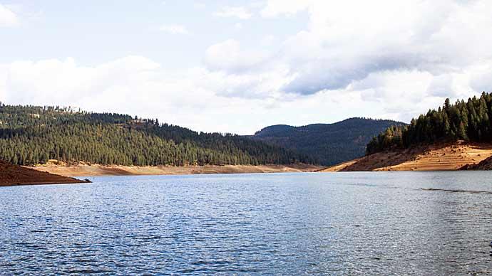
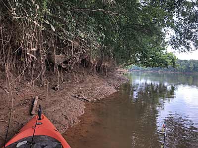
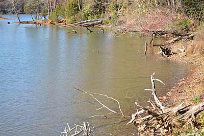
Maps show the overall layout of a body of water and its depths. But from late fall through winter, and during times of summer drought, when the water level is usually at its lowest, is the best time to see it for yourself. Pieces of isolated cover, bottom composition, and channels are easily spotted without several feet of water in your way. And while they may not hold fish then, they will when the water level returns to normal.
Knowing these spots’ locations is only half the battle. The rest revolves around marking them, so it’s easy to return when bass populate them. Here’s how to accomplish both.
Creek channels
Bass use creek channels year-round. They act as routes onto and off shallow flats, whether bass are looking for spawning sites during spring or hunting schools of baitfish in the fall. And if a cold front or storm rolls in during the spawn or fishing pressure picks up, bass can retreat to these slightly deeper spots and find refuge.
Creek channels are marked on most paper and electronic maps. But they aren’t easy to find when you look out over the water, at least until the water level is low. Shallow flats, for example, may be one of the only places you’ll still find water.
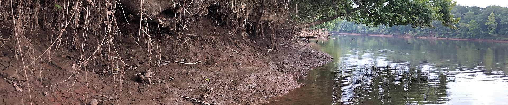
Even if the water isn’t low enough to spot the actual creek channel, you’ll see clues revealing its location. Look at the topography that’s exposed. Steeper sections usually point to an outside bend, whereas flat spots can mean an inside bend, where current slowed and sediment was deposited.
Learn everything you can about the channels, including noting unique spots along their length. Bends, cover, and portions that run along the shore will concentrate bass. Look for depressions on flats, too. They may look like puddles when the water level is low. These also function as security spots for shallow water bass.
Bottom composition changes
When it comes to bass fishing, you need to know more about the bottom than how far it’s from the surface. Sure, depth is an essential key to unlocking the current pattern. But bottom composition plays a role, too. Rock, sand, clay — they all attract bass for different reasons. So, note where you see each during low water.
Edges — where two or more bottom types meet — are productive spots. Bass will feed and hold along them. And like other edges, such as the outside of aquatic vegetation beds or timber lines, bass travel along them, heading shallow from deep and vice versa.
Knowing the bottom composition will direct you where to fish. If you know the bank going into a creek is muck but turns into gravel for the middle third, you may want to avoid that outside stretch. And spawning bass are attracted to sandy or gravel bottoms if the water is clear enough for the sun to reach them. So, if a portion of a cove’s bottom is covered in sand and the rest in muck, you’ll know where to spend your time searching for spawners once the water temperature reaches the 60s in the spring.
Look for isolated patches of hard bottom, whether sand or rock. A rocky spot in a mucky flat that fills with aquatic vegetation can be a bass magnet. Grass won’t grow well or there, creating openings that attract baitfish and crawfish. That’s a buffet for bass.
Isolated pieces of cover
Isolated pieces of cover can hold bass any time of the year. But they seem to produce best when bass are on the move. In early summer, they stop at these spots during post-spawn as they head toward deeper water. And in the fall, they use them as ambush points, feeding on baitfish and making their way to shallow water, where conditions are more comfortable.
Small in scale, an isolated piece of cover can be almost anything. A single large rock counts. So does a stump or small pile of brush. You may only catch a glimpse of one barely peaking out of the water, even when the level is low. While it may be too little to attract bass at this point, knowing where it is come spring after rain or snow melt raises the water level will be necessary. Springtime bass, for example, will use them even if the normal water level barely covers their back.
But you’ll want to take note of more than its location. For example, knowing how a sunken brush is positioned makes it easier to fish. If you retrieve your lure, especially a crankbait, from the trunk toward the branches, it’s less likely to snag. That means more chances to catch a bass before you have to disturb the brush while retrieving your snagged lure.
These pieces of cover are too small for publishers to note on maps — electronic or paper — unless they’re a hazard to navigation. And those that are aren’t much help to you because everyone knows about them.
Mark them
Seeing is believing when finding isolated pieces of cover, bottom changes, and channels when the water is low. But that won’t be possible when they’re hidden under normal water levels return. So, you’ll need a reliable way to return to the spots you find.
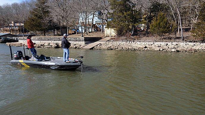
The easiest way to mark these spots is with a GPS waypoint. If there is enough water, you can use your boat’s electronics. If it’s high and dry, you could walk to them and use a handheld version, transferring the waypoints to your boat’s electronics later. If you can’t get that close, there are other ways.
The water is shallow around these spots, so you’ll want to position your boat away from them anyway, so bass aren’t spooked. Drop waypoints away from them, then devise a system for how to cast to them. You could use different icons. One could mean cast parallel to the shore, and a different one means cast perpendicular. Take note of features on the shore. If you line up a utility pole with the corner of a particular lakeside cabin, for example, when your boat is on the waypoint, you’ll know which direction to cast and reach the spot. It's an updated version of the triangulation method used before GPS to locate spots. Be sure to pick objects that are unlikely to be removed. Many hot spots have been lost because a tree was cut down or the dock moved.
While brief notes can be electronically attached to waypoints, there’s room for plenty more on paper maps. They may not be in style today, but these charts still provide a wealth of information, especially when you note your observations and use them in conjunction with your electronics.
Don’t limit yourself to noting pieces of isolated cover that you deem best. When the water is low, none of them can be considered better than the rest. Only the bass will decide which ones deserve their attention. And they all might hold one or two at some point. Fishing them when the water returns to normal level is the only way that you’ll determine which ones consistently produce fish.