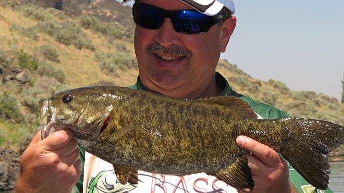
Rick Clunn has been a pro bass fisherman for over 40 years and knows that the first step to catching fish is finding them. Facing a large body of water can be daunting, especially if you have never been there. You may have acres of fishy-looking water in front of you: coves, sloughs, rip-rap, lay downs – the list of possible bass haunts is endless. So how on earth do you decide where to start? If you grab a bait and start pounding the bank, it could take forever to figure them out. There’s a much better way.
Start smart by thinking like a bass. Bass are simply animals, and they are ruled by instinct. They have incredible senses that help them survive and thrive, but you can use that to your advantage. Bass, like all animals (even us!), are happiest under certain conditions. Comfortable temperatures, plenty of oxygen, and a steady food supply are all necessary for a bass to be living the good life. These factors change with the seasons, so once you figure out where the bass winter and where they move for summer vacation, you’ll be well on your way to catching them.
The seasonal pattern determines the lake area you should be fishing in to get the most bites at a particular time of year. Your most important asset for developing a seasonal pattern is your head. Tackle complements your abilities. Recall past experiences and reapply them in the future. Keep records of your fishing successes–you are the most reliable source of information. Anything beyond yourself, says Clunn, is just “a degree of lies.” In other words, think twice about using the information you hear from the guy on stage collecting the check. Is he telling the truth, or is he misleading the competition?
Clunn says it took him a year of keeping notes to pay off for him. He won his first tournament with fifteen fish for 33 pounds. His notes included what area of the lake and what pattern won at that time of year on that kind of lake. He emphasizes that bass are the same no matter where you fish for them. If you doubt that, remember that Clunn is the same guy who wins on gin-clear 200-foot-deep reservoirs like Lake Mead and in a foot of muddy water on the Mississippi River.
When Clunn is making notes, he takes care not to mix, unlike bodies of water. He keeps separate records for man-made lakes, rivers, tidal waters, etc. He sectionalizes lake maps: Area One includes the deepest, clearest, most stable areas. This would be the main lake area of large reservoirs and places like that. Area Two encompasses the mid-range depths. Area Three is shallow water, usually where rivers and creeks feed into the lake. There may be several of each type of area on each body of water.
Once Clunn has the entire body of water divided into the three kinds of areas, he begins to do the same for individual coves, marking out the deep parts as Area Ones, the mid-depths as Area Twos, and the shallowest areas as Threes. In his notes, he keeps track of the area where fish were caught in. He uses his own experiences and even published magazine tournament results for his notes. Don’t look for techniques, lures, etc., he says–keep track of what area the fish were caught in and the conditions at the time.
Keeping these records will do two things for you: it will eliminate non-productive water and put you in the places where you have the best chance of getting the most bites. There is no point in fishing shallow, for example, if your notes tell you that most of the fish were caught at twenty-five feet for the past five years in these conditions.
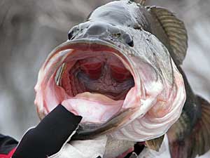
Even before you have a year or so of notes, there are ways to determine the best places to start looking for bass. Simple bass biology will give you a boost. Bass don’t move as often when the water temperature is below 50 or above 80. During colder months, they tend to move toward warmer water, so keep an eye on your graph as you explore the water. A difference of one or two degrees can be enough to draw bass or make them a bit friskier. Fortunately for us, bass seem to eat when they are hungry and even when they are not. They tend to eat whenever they see possible food. According to the Southern Regional Aquaculture Center, bass don’t learn quickly. A large percentage of the bass population will fall for the same lure time after time, which is also good news for us.
Most fishermen know that a good rule of thumb is to look for shallow bass during the spawn, deeper in winter, and mid-range in summer. But that can depend on where you live. Summer fishing often means deep-water fishing in the clear deep reservoirs out west. Wes McCracken is an avid bass fisherman in Arizona, and he says he spends a lot of time looking at maps. Some of his best spots are so subtle that many people would overlook them. One of his favorite spots is one that boats run right over every day on their way out from the launch ramp. On the map, it simply looks like a tiny finger right out next to a river channel. On a lake map with 10-foot contour intervals, it is shown by a single looped line. Since it is so far from shore, not many people notice it, much less stop to fish it. That’s the kind of thing he looks for. “Everybody finds the obvious stuff,” he explains.
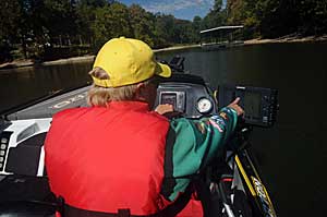
When Wes first locates a new area that looks good, he first circles it and gets a 3-D picture of it fixed in his mind. Boat control is crucial – he wants to know where he is relative to the structure. He finds some of his spots on the map first, and some he finds on the water and locates on the map later. “Our paper maps aren’t that great, but they’re better than most people give them credit for,” he says. He’s been known to spend hours slowly motoring around the lake, searching for structure like a crappie fisherman.
“In the summer, the top of a good hump will be somewhere in the thermocline,” he says. Wes has found that the dirtier the water is, the shallower the thermocline, which means that it can be twenty-five feet deep or even more in clear water.
What the heck is the thermocline? Well, warm water is less dense than cold water, so it will sit on top of the denser water with a thin layer called the thermocline separating them. Because the warm layer gets sun all day, there isn’t much mixing of the two layers. As summer progresses, there is less and less oxygen below the thermocline because the stuff living down there is using it all up. There isn’t much point in fishing below the thermocline most of the time, so it’s handy if you know how to find it. It isn’t that difficult – just put your graph on manual and turn the sensitivity way up – over 90%. You should be able to see the thermocline as a thin black line. The best places to fish will be structure at that depth.
Looking at the lake map, you can find major seasonal structure at home. Is there a finger that sticks out into deep water and intersects the thermocline level? Maybe there is a hump, even an old building, or a submerged road at the proper depth. I regularly fish a lake with an annual vertical depth change of up to 100 feet. Figuring out the depth of structure can be difficult. Two things make this a lot easier: me marking the map and the county marking the ramp. When we launch the boat, we check the ramp because metal plaques are embedded in the concrete that marks the water level. The entire pool is 1702, so if the water is lapping at the plaque that says 1635, we do the math. This wouldn’t do much good except that we have also marked our lake map. Using differently colored Sharpies, we traced the contour lines at 20, 40, 60, and 80 feet. So if the green line is 1640, we know that the current lake level is somewhere around there. If the thermocline is at 20 feet, we look for structure that is the next color down - things like humps, nice ridges, etc.
In spring and fall, you’ll want to focus on areas with nice flat, shallow banks, and you can spot those by looking for areas where the contour lines are far apart. To find fantastic drop-offs for summer and winter, look for contour lines that are closer together, especially at the ends of flattish points and near old river and creek channels. Be sure to use your map as a way of taking notes. If you get into a perfect bite, mark it on the map and give it a code number so you can make notes about the time of year and specific conditions in your fishing notebook. By the way, waterproof maps and notebooks are convenient for keeping detailed records. Use a pencil – a lot of ink will run when it gets wet.
If you’re planning a trip to a body of water that is new to you, buy a good map of it as soon as you can. By applying your seasonal knowledge of your home lake to the map of the new one, you should be able to get an excellent idea of where to start fishing.