Detailed waterproof and electronic lake maps can be found at Tackle Warehouse: https://bit.ly/3qYdEF0
https://dev.bassresource.com/bass-fishing-videos/use-lake-map.html
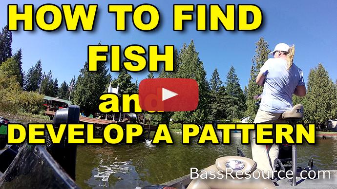
How To Find Fish
By
/ February 28, 2021
How to read a lake map the easy way! Learn how to identify key structure, and why they’re important to fishing in this introductory video.
Transcript
Hey, folks. Glenn May here with BassResource.com. And today, I wanna talk about reading maps. There are some key things you need to understand when you're reading the map and how it's gonna pertain to your fishing that's gonna make you a lot more successful when you're on the water.
And maps can be confusing, there's all kinds of marks and things on it that are hard to understand if you haven't looked at them very well or don't know much about them. And so I'm gonna take you through six main things on maps and what to look for, how to find them, and what they mean to you when it comes to fishing. And those are contours, points, flats, humps, saddles, and channels. So, let's dive right into it.
The first thing you need to understand about reading maps is contours. Maps, by the way, I'm talking about electronic maps and paper maps, it's the same thing. Contour lines are areas that mark different depths in the water. A contour line can say, for example, it might be 9 feet under water, or 10 feet under water. It will say that, in the map key, it will tell you what these contour lines are.
Understand it's relative to the normal pool of the water. So, if you're in a reservoir where the water fluctuates, or maybe you're on a lake where you've had recent flooding, or maybe you're in a drought and the water level is down 2 feet, you need to do an offset. So, that contour line is at 9 feet, and now it's 3 feet below normal pool, well, now that contour line is at 6 feet, or say, for example, it flooded 2 feet, now that contour line is at 11 feet. Now, on a lot of sophisticated electronics, you can actually go in there and make an offset. You can tell it what the pool, the level is of the water, and then all those contour lines will automatically change, and now they're accurate for that day on the water. Kind of cool. If you've got it, use it. That's a great way so you don't have to mentally keep changing, figuring out what's going on.
But what these contour lines are, it gives you an idea of what the lay of the land is underneath the water. It's important to know what each line represents. Maps are different. Sometimes they are 1 foot increments, sometimes they’re 5 foot increments, or 10 foot increments, some of them are 20 foot increments. Read that key so you understand what... When you got one line and there's another line next to it, how much of an incremental change that is, that's really important when you're looking at these maps.
The closer those lines are, the quicker the drop, the quicker the change of depth. So, when you see a bunch of lines that are all stacked up against each other, you can see that's almost a vertical drop or a very steep drop. Whereas if they're really spaced far apart, that's more of a slow, long flat. Very little change in bottom depth, just gradual change. That's really important to understand that because that helps you find those drop-offs, those steep points, those flats, those type of things. We'll get into that in a minute. Basically, when you're looking at areas that have the like, say, for example, a contour line is far apart, that's a flat. Simple as that. That's what's called a flat because the bottom is basically flat.
Now, with that in mind, let's look at what points are and secondary points. Points are...essentially, they're pieces of land that stick out from an otherwise flat shoreline and stick out into the lake. That's really all a point is. It doesn't have to be literally a point, it can be just an abutment. Some part of the land comes out away from the shoreline, it sticks out a bit. And so they come in many shapes and forms, but that's essentially what a point is.
Now, a main lake point sometimes are also called primary points. This is why it gets confusing. Main lake points and primary points are the same thing. They're synonyms. They mean the exact same thing. What those are, are those points that stick out into the main body of water in a lake. Now, if you've got a natural lake, you may have coves, you may have little pockets. I'm not talking about those, you get those main section of water where all the boaters are. A lot of times the water skiers like to go. That main open area, that's your main lake. So, you've got any points that stick into that, that's a main lake point or a primary point.
Now, if you're looking at a reservoir or maybe in rivers, you've got these tributaries, these little side streams, side areas that come into the main lake. Go up in those and you've got points in there. Those are what's called secondary points. It's as simple as that. Points that you find in those tributaries and in those bays and in those coves are secondary points.
What can be a little bit confusing though, is sometimes secondary points aren't necessarily visible from the land. Now, if you're looking at a flat shoreline, sometimes there are points that are under the water that come out. People consider those secondary points because you can't see the point. It's a secondary point, it's underwater. So, this is where it can get confusing because people use these terms universally. So, just understand those are like the different terminology they use and the definitions.
But you can look at those contour lines and now you get an idea. Is this a really sharp steep point that drops off quickly in the water, or is this a long tapering point? Those will have the contour lines be further apart. The steeper ones, the contour lines will be a lot closer together. So, this is very helpful in understanding what types of structure you have available on your lake.
So, now let's talk about the different flats. As I mentioned, the contour lines are further apart. The bottom doesn't necessarily change very quick, that's a flat. But when it comes to fishing, typically, the flats you wanna look at are the ones that are somewhat protected, not necessarily in the main body of water. Those are like the back ends of coves and tributaries, and in bays. Those that are protected by the land, if you will, sometimes the land is really, you got a steep shoreline, so it protects them from the wind. Those are really important to fish during the spawn, for example. Those are little spawning areas where the fish are gonna be during the spring, but even during the summer and in the fall, they'll go up there to feed on bait fish.
On the main bodies of water, they tend to get... If you're on a busy lake, again, like I said, a lot of water skiers are out there and it may be a flat there, but it's getting pounded by waves all day long and by boat traffic and maybe the wind, it's exposed to the wind, and so they might not be as productive. So, it's important to understand when you're looking at flats, like where are they positioned and what type of flats might be more productive than others. Okay. So, this map study really helps you to find those out rather than just driving around the lake when you're on the water.
Now, let's talk a little bit about humps. Humps are basically an area that is higher than the rest of the surrounding areas on the lake bottom. A hump is like a pimple. An underwater island if you wanna think of it that way, but a much smaller one. But a hump can be very productive, depending on where it's located on the lake.
Usually, humps that come up quite a ways out of the water, they have different things on them. There may be a different odd shape. And depending on where the current is, they could block current. If you have current in the lake or if it's in a river or if it's in a reservoir and they're pulling water, fish may set up on the leeward side of that hump, or may have weeds on the top of the hump but not down near the bottom. It's important to note that kind of stuff, even if you can't see the weeds on the lake map, you can at least get an idea of where they might be or where those weeds might be.
And humps are different. In bays, that may be a stopping point that the fish use when they're migrating in the fall and in the spring up and down back into the back of coves and back out, that might be a stopping place. So, it's worth an area to go check out during those times of the year.
So, humps are really important to find because that can hold a lot of fish, depending on the time of year, but make sure you mark them. I like to categorize on the ones that are back in bays and in tributaries. I like to categorize those separately than main lake humps, just because if I start catching fish on one type of hump, then I can eliminate all the others. Now, I do that with points too, primary points or main lake points or secondary points, the type of flats. You start categorizing those, where they are relative to the lake. You start to be able to get an idea when you're on the water, which ones are more productive, so you can go directly to those and skip the ones that aren't as productive.
Let's talk a little bit about saddles. Saddles. Since I talked about humps, saddles typically is the land between two humps. It's generally shallower than the surrounding areas, but deeper than the tops of the two humps. This could also be the land between, say, two islands, or if you've got a hump that's close to shore, it could be the land between the hump and the shoreline or the island and the shoreline.
Saddles are really important because a lot of times, especially if there's current, whether it's wind driven current, current from the river, or if maybe they're pulling water in a reservoir, it funnels the water right through there and all the food chain goes. The insects and bait fish will get funneled through there and the bass will set up on the down-current side just eating, that little conveyor belt is just feeding them, and they're just eating away.
So, it's important to know where those are relative to, again, positioning of the lake and where the current might be or where the wind might be coming from. Understand those relative positions. Are they more of a north-south position than east-west position, for example? If you find those little saddles, those can be really productive.
And they may provide, those saddles themselves may have enough protection from the two humps or two islands that that actually might be a good spawning area during the spring. So, things to look at and consider when you're planning out your day of fishing.
And then I also wanna talk a little bit about channels. Channels are...this usually applies mostly with reservoirs, where there wasn't a reservoir there before, they put a dam in, they filled it up. Before that dam was made, before that reservoir was made, there were original creek channels that fed somewhere to a river at some point. That's what I'm talking about. The channels are the original creeks that were there before the water was filled up.
And you can find those on a map, they're either two dotted lines close together, or sometimes are a solid line. I've seen in different ways on different maps. But channels can be really important to find for fishing because they could, for example, when they get really close to the shoreline, there's a little creek bend where it turns that can be an area. It's deep water near shallow where the fish might go to during different times of the year.
You have to take it with a grain of salt because the older the reservoir is, more often than not, the more of those channels get silted in and some of them just disappear entirely. There's nothing there for the fish to hold on. However, even then, if there was a sharp creek channel, a sharp creek bend somewhere, that original creek when it was there, it carved away parts of the landscape. And so there may be a steep structure right there where that bend is. Just if it turned in like this, right here will be the steep part. And that might still remain even though the rest of the channel is silted in.
And if the channel isn't silted in, well, bonus. Now, you can look at... Those are areas where the fish might go. I know, for example, in the fall or in the spring, you're looking at creeks that are up tributaries where if a big front comes through, a lot of times the bait fish will come down and sit right at the bottom of those creek channels because that's the deepest area in that whole vicinity, and the bass will follow. So, that can be an area to pay attention to during those times of the year.
And also, look at other structure that you've looked at before. For example, if you've got a point that comes down right next to a creek channel, that's an intersection. You got two key structures there. That could be a real productive spot.
Those are the things you wanna look at. As you start to look at your map study, you start to start marking these areas that look productive. That's why the importance of map study is because, otherwise, you might not even see these stuff, those secondary points that are underwater I told you about, a lot of fishermen go right over the top of them not even knowing they're there, unless they've done their map study. So, this is where it's really important to put all this stuff together.
So, those are the six main things for you to look at and learn about when you're learning map study.
Now, one more bonus thing. At this point, a lot of people have turned off the video, they're not watching anymore. So, as you know, in some of my videos, I like to reward you guys with a little extra tidbit for those who are still watching. So, here it is. Bonus time.
When it comes to maps, get as many maps of that lake as possible, or river, or whatever it is you're looking at. Not one single map has it all. Period. Now, some lakes are really popular like Kentucky Lake, and Lake Fork, and Guntersville, so there's multiple maps available from different manufacturers.
But even if you're fishing in a lake or river that isn't super popular, you can still find multiple maps, not only the typical fishing maps that you would find, but look at navigation or Atlas maps. Atlases, they're for navigable waters. And those will show things that aren't on any other map like sunken ships and certain rock piles and maybe secondary channels.
And other maps, you can find, like Department of Wildlife, oftentimes they have their own topography maps that you can find on these different lakes that might show you some things that weren't otherwise there, or maybe there's even maps that you can't find other maps from other makers, you can still find them from your local Department of Wildlife. But the more maps you have, the more detail you're gonna get.
Some maps show where weeds are, some show where stump fields are. The electronic maps sometimes they have people that add to it and comments, who will actually mark it up themselves and contribute to a community. So, there's even more information there. Some have finer level of detail. I know in particular one lake that I used to fish all the time had what I thought was a big, huge ledge on it based upon a map I was looking at. But then when I looked at the electronic version of that same area, it ended up being two giant rocks. A lot more level of detail was there. And same with electronics, there's different manufacturers for electronic maps.
So, the more that you can get, the more detail you're gonna get, the more information that you're gonna have, the better informed you're gonna be. And that way you're gonna catch a lot more fish.
So, I hope those tips help. For more tips and tricks like this, visit BassResource.com.
BassResource may receive a portion of revenues if you make a purchase using a link above.