| Help is where you find it. Thinking of building a pond? Here's a few suggestions |
|
1) Get in touch with the closest office of the NRCS. (Natural Resources Conservation Service) They usually office in the USDA building in the county seat. They have maps, aerial photos and expertise. 2) Spend time online. Ask questions at www.pondboss.com. Click on "Ask the Boss." Be amazed at the wealth of knowledge. Search the archives or ask your own questions. It's free. 3) Ask around, talk with long time earthmovers. These guys are always resourceful. 4) Find your property via topo maps online. Some sites are free, others charge a nominal fee. Common sites are listed below. TopoZone www.topozone.comInteractive USGS topo maps of the entire United States.Bing Maps bing.com/maps/View maps and aerial photos of various parts of the Earth.USGS Topographic Maps USGS Geography Map Products. The best known USGS maps are the 1:24000-scale topographic maps, also known as 7.5-minute quadrangles. |
During thirty-something years of pushing dirt, and being pushed around by the business of moving dirt, I have learned volumes. When someone asks me how much I know, I tell them, "Enough to fill the Rose Bowl." Sounds like a lot, until we realize the entire earth is covered with dirt, even at the bottom of a lake. So, the Rose Bowl really isn't that much. I learn something every day. That's part of the fun, and the challenge, of building lakes and ponds.
How much help do you need?
Well, how much do you know? The answer to this question answers the first one.
Water runs down hill. We always know that, of course...well most of the time we do. Water is the same level from one shoreline to the other. Not all people seem to realize that little fact.
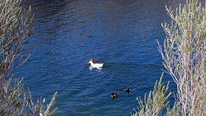
A pond construction project can be simple. Or, it can be simply complex. Is there enough watershed drainage to fill the lake? Should the lake have some kind of pipe outlet system? If so, what kind and how big? How much maintenance will the lake need when completed and for how long? How wide should the top of the dam be for a road? What are the best fish to stock in a half acre pond? Are there any fish I cannot stock in ten acres of water? How much will the water go up and down from season to season? How much rainfall do we get in a year, and how much do I need to come into my pond? What kind of dock and how big should it be? What about a boat ramp? Do I need to worry about flooding that underground gas pipeline easement? What about the power lines? Who can tell me how big my lake can be before I need legal help? What kinds of permits are there? Why do I want grass on the dam? Should it be fenced? What should I do to keep my lake from filling up with dirt? How can I get the silt out when it does fill up? What do I do with the silt when I do finally get it out? What angle should the slopes be? How deep is deep enough? What about livestock and wildlife? Animals want to drink, too. Why in the world am I building this dadgum lake, anyway? There's too much to think about.
No there's not.
When you are preparing to move any part of the Earth, it always deserves careful thought. When dirt is disturbed, it cannot be the same again for years. And, if you are building a lake, you are completely changing the existing habitat for generations to come. So, where do you go for help?
Go where you find it. Sounds like a flip answer, but it's true. One thing I have learned about the consulting business, most consultants know a lot about what they know. But, what they know may not be exactly what you need. So, study different sources. Pond Boss magazine is a great resource. But, it's a magazine. Those writers may not cover the topics you need at a particular time. The local office of the Natural Resources Conservation Service can be quite helpful. They know soils, they have engineering ability. There's an NRCS office in almost every county in the nation. The NRCS is a good place to start. While this federal agency is quite qualified to engineer and oversee the construction of a dam, most of them don't really understand your bottom line usage. If you are building a fishing lake, give thought to underwater habitat, structure and cover. If a swimming hole is the love of your water life, build it completely different.
Let me introduce you to Laser-Eye Linda. Linda Hermes, from Lindsay, Texas, called and wanted to build a fishing lake. She was building a house, wanted a bit of land cleared and a house pad. My job was to look things over her new property and counsel about those things I know. We looked, we talked, we looked more, talked more. Deciding to start the task list with the pond, we chose to lay out a water line, marked with surveyor's flags. She wanted to visualize where the water might come. Lucky for me, I had a few tools in my trusty Ford F250 pickup truck. We set up a laser level, and then began taking a few elevation shots. It was pretty obvious where downhill was, because I could see water moving through a small creek. But, the lay of the land was a bit confusing to me in the beginning, trying to figure out how tall a dam should be on this gently falling piece of property. I was also trying to look through brush, undergrowth and trees. It was tough to judge how far water would back up into the creek and stay on her property.
As we found a benchmark for the water line, I was amazed at Laser-Eye Linda's ability to judge elevations. She could guess or estimate almost everything we needed to know. Every time I opened my mouth, I knew I should have kept it shut. Her eyes were way better than mine, and I make a living doing this stuff.
I like to play a game with people, letting them guess what is going on with a site... how deep the water might be, how tall the dam will be, where the shoreline will be when the pond or lake is full. Often, I make a small wager, just for fun. This lady missed nothing. After about five rounds of double or nothing, I cut the tolerance to a few tenths of an inch. Finally, she missed enough to let me off the hook.
There are all kinds of tools to help every step of the way. Topographical maps and current aerial photos are especially invaluable. Some office supply stores sell them, and you can even find different maps online.
When maps have been adequately studied, a level on a tripod becomes extremely helpful. Use the level several times during the course of your project. It's one thing to plan, but another to continually follow what you are doing. Use a level to stay focused on your water line, and dam height.
Here's the most important thought for the day. Every single project I have worked on has had an unexpected turn. Be prepared to deal with things you didn't think of. You can do all the homework, be totally prepared, and still have something happen you had not thought of.
Here's an extreme example.
I recently met a man named Stanley Williams. He is one of the finest gentlemen I have ever met. He has been in the pond dam designing business in west Texas for years. Keep in mind; people and land in west Texas have all kinds of interesting problems you won't see in every day America. Stanley works around Crowell, Texas, an area renowned as hot, mostly dry, on the fringes of a desert. Precipitation is hit or miss. It might rain three inches in one spot, and less than a quarter mile away not a drop hits parched soil. West Texas storms grow fast, drop lots of rain locally, then move on or fall apart. Stanley conspired with me recently on a nice project just south of Crowell. He designed the dam, I built a lake. A nice sized lake, just smaller than 30 acres. It will be a bass fisherman's dream lake. I just hope it fills up in the next few years in that dry country. Soils looked great, except clay was extremely dry. Dry clay doesn't compact nearly as well as clay with a bit of moisture. Stanley taught me a lot about working with dry dirt. You don't read that in a book or on a website.
Here's a special way Stanley helped. Not only does he know the ins and outs of engineering a dam, Stanley Williams understands local soils. This site outside Crowell has outcroppings of the mineral, gypsum. In nature, the stuff looks like crystallized glass. But, pick up a piece of it, and it's crumbly. You can actually break it with your fingers. From a distance, it looks opaque white, but pick it up and it looks like shards of broken glass. I wouldn't have given it a second thought.
Stanley changed my thinking. He asked, "Mike, do you know much about gypsum?"
I wasn't about to embarrass myself with what I was actually thinking. My brain said, "Heck, I hear Largemouth Black Bass Bob Lusk talk about it all the time. He likes it. He actually tells people from time to time to put it in their ponds to clear muddy water."
The amount you add is not dangerous. Key word here is "dangerous."
Stanley told me a story of a nearby lake that looked great after construction. The contractor had nudged a gypsum deposit on the lake bottom, but no one was too concerned. He pushed dry clay on top of the crusty gypsum during the course of business building the lake. He finished the job and moved on to the next one. When the lake filled with water, guess what happened? Soils became saturated, water dissolved the gypsum, like sugar. A big void was created, and the lake developed an unnatural drain, like a giant bathtub unplugged. Drained the sucker. Empty.
Stanley has all the latest calculators and computers, but can add and subtract in his head faster than a race car driver can turn left. He's accurate, too. Stanley was called to the site, quickly analyzed the situation, and using his years of experience, knowledge of local soils, including gypsum, came up with a solution. With his engineering mind and years of practical experience, he sifted through the mathematical equations, and figured this gaping pocket could best be filled with big rocks, then small rocks, then gravel and topped with two feet of heavily compacted moist clay. Sounds pretty easy, until you stand along the open edge of a gaping hole, looking deep down into a wet craggy spot with unquestionably lousy soils. It was a dangerous job to repair, but Stanley had the right idea. His solution worked well.
Of course, this problem was an exception. But, if the land owner didn't have Stanley, he may not have had such a practical, and economical, solution. Most other problems you might encounter are quite as critical.
Not all projects need much more than someone to point and say, "dig." The NRCS is a great place to start your information gathering process. They have lots of maps and well trained people. The biggest problem with the NRCS is they are overworked and have people pulling on them from all directions all the time. Squeaky wheels often get the grease. There are lots of private engineering firms, as well as excavation contractors. Know your goals, then find those people most helpful to get you where you want to go. Visualize your project as much as possible, so you can pass your vision to those you surround yourself with. Maps, aerial photos, people with engineering experience, lake designers, fisheries pros, excavation contractors. Go online, visit www.pondboss.com and click on "Ask the Boss." Find people who have done what you want to do, and get in touch with them. Interview other landowners, learn from other's successes and failures. Plan as much as possible, do your homework. The more you plan the less we change. There is always something to deal with when it comes to digging holes. A project will look a lot different after it gets started. So expect to make some adjustments. Expect the unexpected.
You may not learn enough to fill the Rose Bowl, but you will glean enough to design, build, stock and manage your dream lake. Just add water.
The author is a 35-year veteran of pond construction, from dairy lagoons in Ohio to golf course water hazards in Florida to recreational fishing ponds in Oklahoma. He may be reached at Otto's Pond Service 1-800-882-DIRT
Reprinted with permission from Pond Boss Magazine